Showing posts with label Springfield. Show all posts

Friday, December 11, 2015

Stone Chapel...Springfield, Missouri


DATE:  November 14, 2015

HISTORICAL SITE:  Stone Chapel


LOCATION:  E. Central Street, Springfield, Greene Co., Missouri

MARKER #:  82000583

DEDICATED:  October 21, 1982

Stone Chapel   Long recognized as a symbol of Drury College, Stone Chapel resulted from a gift by Mrs. Valerie G. Stone, Malden Mass., and named for her. Cornerstone was laid Nov. 16, 1880. Fire loss delayed completion until 1892. Special features: First bldg. made of stone, pipe organ, and stained glass windows.

MARKER PLACED BY:  Springfield Historical Sites Board  City-County Bicentennial Committee

PERSONAL REFLECTIONS: 

Like Dirk and I seem to do way too often, we arrived at the chapel just as dusk was falling.

The chapel is located on the grounds of Drury University, which was established in 1873. It was named Stone Chapel because it’s the oldest stone structure in Springfield…or so I thought! It was actually named Stone Chapel after Valerie G. Stone, one of its benefactors who gave the initial $5,000.00 contribution but then another $20,000.00 later. So, it was named after her.

In spite of a fierce snowstorm, the laying of the cornerstone on November 16, 1880, was very well attended. The cornerstone was put in place during a heavy snowstorm on November 16, 1880.  

I was so fortunate during this trip. I had packed for cold weather at Dirk’s insistence, although really, California’s answer to winter is to put long sleeves on our summer clothes so the material is just as thin…just with long sleeves. I brought along only 2 short sleeve shirts and probably wore those more than all my nice warm sweaters. People complained about the unseasonably warm weather, but I just smiled and thanked the El Nino we are having this year.
 
On December 12, 1882, classes were in session on the 2nd floor when an explosion ripped through the church as the furnace exploded. Thankfully, everyone got out unhurt but their nice new chapel was destroyed. It was said that most of the town watched the bell tower come crashing down.

It took another decade to rebuild the chapel on its original foundation at a cost of $45,000.00

The first commencement class ceremony to be held in the chapel was in 1892…all female.

In 1906, the Chalfant Organ was put in place where it is still used today

This has nothing to do with the church, but I thought it was an interesting story nonetheless.

Near the church, on the Drury campus are two cannons left behind from the Civil War era. They moved around Springfield quite a bit before calling Drury University home in the late 1800’s.

They always sat free, but sometime soon after the cannons were placed on campus, one went missing while the other was often borrowed for parades, memorials and other celebrations.

Then in 1905, Springfield High School borrowed it and for some reason the Drury campus manager told them they could keep it. Well, the Drury students didn’t agree, so they went and took it back. They mounted it on a solid stone pedestal in its current location, facing the street.

In 1913, while cleaning out a warehouse area, the second cannon turned up at the Frisco shops. It took some negotiation, but the cannon ended up back on Drury University property where it was mounted across from the other one.

Thursday, December 10, 2015

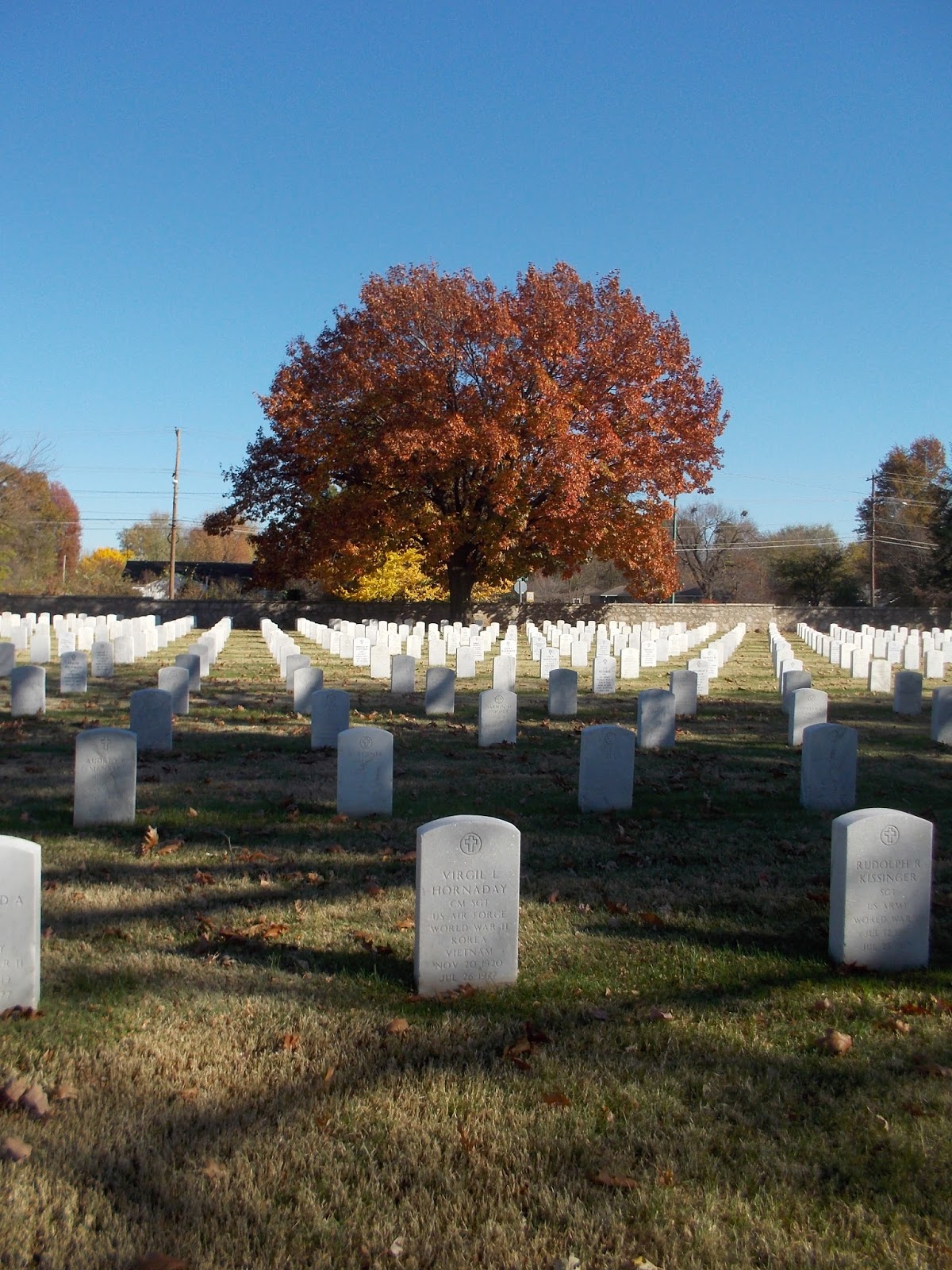
Springfield National Cemetery....Springfield, Missouri


DATE:  November 14, 2015

HISTORICAL SITE:  Springfield National Cemetery
 

LOCATION:  1702 E. Seminole St., Springfield, Greene Co., Missouri

MARKER #:  99001045

DEDICATED:  August 27, 1999

"This national cemetery has been listed in The National Register of Historic Places"

MARKER PLACED BY:  United States Department of the Interior

PERSONAL REFLECTIONS: 

“It is foolish and wrong to mourn the men who died. Rather we should thank God that such men lived” – General George S. Patton

I think I’ve mentioned before that there is this fascination when one place I’ve blogged about becomes connected to another. That’s the case with the Springfield National Cemetery.

This area was home to the Kickapoo Indians and the area around the cemetery was known as Kickapoo Prairie. Missouri was truly the edge of civilization before people started making their way west. We’ve seen, as with the Patee hotel, that people knew they were going into or coming out of the wilderness.


Slavery, among other issues, had always been a dividing point in the United States and it came to a head on April 12, 1861, when the Confederates opened fire on the Union garrison at Fort Sumter, South Carolina.

Not long after, the Missouri legislators met and voted against secession but said if the north declared war on the south, then they would fight for the Confederacy.

In August 1861, the first major engagement west of the Mississippi River took place at Wilson’s Creek, about 15 miles north of the cemetery. The win really went to the Confederates but they failed to push forward and gave the federal military time to regroup. The south would never really hold Missouri although the state was full of southern sympathizers.

The city bought 80 acres on the outskirts of Springfield. The cemetery was named Springfield National Cemetery, not because it was part of the federal government, but because that was the name of the street that used to run on the south border of the land. The street disappeared when the cemetery was expanded.
 The civic leaders gave the U.S. government the choice of areas within the cemetery for the sole purpose of burying Union soldiers and most had fought at Wilson’s Creek. The cemetery opened in 1867, and soldiers buried around the area were disinterred and reburied here.

In the end, there would be 1,514 Union soldiers buried with 719 unknowns. There were 566 Confederates and the majority of those were unknown. There’s something about standing there and you can see a sea of “Unknown Confederate Soldier” tombstones.

There are several monuments within the cemetery. The first one you see was placed in 1888 to the memory of Union General Nathaniel Lyon, the commanding officer at Wilson’s Creek and the 1st Union General to die in the Civil War.

A few years later, in 1901, a monument to Confederate General Sterling Price was raised. Price was once the Governor of Missouri and the Confederate Commander at Wilson’s Creek.

A local doctor, T.J. Bailey, had wanted a monument put up upon his death so in 1907 it was placed with the inscription “erected under the provisions of the last will of Dr. Thomas Bailey to show his love for the Union and its gallant defenders”

But this wasn’t the only cemetery around. Right next to the National Cemetery, there was a smaller one for Confederate soldiers. In 1911, the Confederate Cemetery Association donated 6 acres with the stipulation that only men who fought on the side of the Confederacy could be buried there. An Act of Congress in 1911 ordered the Secretary of War to accept the confederate cemetery as part of the Springfield National Cemetery.

After WWII, with a lot of space on the Confederate side, the Dept. of Veterans Affairs asked permission of the Confederate Association to bury soldiers from other wars in the area. The permission was given except for a smaller walled off section.

In 1958, the Daughters of the Confederacy put up a monument to all the unknown Confederate soldiers who died at Wilson’s Creek.

It wasn’t until the 1980’s, with amendments to the agreement with the Confederate Cemetery Association, that all veterans were eligible to be buried in the smaller Confederate section.

Yeah, they waited until no one was alive who could argue the point, but then again, who would be buried there as all Confederate soldiers were gone at this point.

There are soldiers buried here from most of America's wars including one revolutionary war veteran. Private William Freeman, born in North Carolina, was a scout for General George Washington. In 1912, his remains were removed from the family farm and re-interred here.

A monument was erected by the Pearl Harbor Survivors Association in 1992 as a tribute to those who died in the attack on Pearl Harbor in 1941 and in 1999, the Sons & Daughters of the American Revolution honored those who died in the revolution with another monument.

In addition, five Buffalo Soldiers are buried here. These were members of African American army regiments created after the Civil War. They were the protectors of settlers moving west, they built and renovated Army posts and camps, and maintained law and order in the western expanses of the country. 

There are also 5 recipients of the Medal Of Honor buried in the cemetery. This is our nation's highest military decoration, given for "conspicuous gallantry and intrepidity at the risk of his life above and beyond the call of duty.”

1999 was also when the cemetery was given the designation and put on the register of historic places.

“I don't have to tell you how fragile this precious gift of freedom is. Every time we hear, watch, or read the news, we are reminded that liberty is a rare commodity in this world.” – President Ronald Reagan

Friday, June 26, 2015

Butterfield Overland Stage – Springfield, Missouri


DATE VISITED:  05/23/2015

HISTORICAL SITE:  Butterfield Overland Stage

LOCATION:  Springfield, Greene Co., Missouri

MARKER #:  18
DEDICATED:  November 1932

"Site of Gen. Nicholas Smith’s Tavern on Boonville Road, Earliest outlet of Springfield, also station of Butterfield Stage route carrying first overland mail from St. Louis to Pacific Coast. Government subsidy $600,000 yearly. First mail left St. Louis Sept. 16, 1858, by rail, arriving Tipton afternoon of same day, then by stage, reaching Springfield 3.15 p.m., Sept. 17, and San Francisco 7.30 a.m., Oct 10. Time 23 days, 23 hours from St. Louis. 2765 miles. Longest mail stage route ever attempted. Bi-weekly service Mondays and Thursdays from St. Louis. 141 (later 167) stations en route. First eastbound stage left San Francisco early Sept. 15, arriving Springfield 3.00 p.m. Oct. 8. Where hundreds welcomed its arrival as great event. Banquet; speeches; fireworks. Time eastward trip, 24 days, 18 hours to St. Louis."

MARKER PLACED BY:  University Club Marker

PERSONAL REFLECTIONS: 

The creator of the stage line, John Butterfield, started as a stagecoach driver and would eventually, with partners such as William Fargo of the Wells Fargo fame, win the bid for an overland mail route from the Mississippi to San Francisco…twice a week…in 25 days.

There were 9 bids but Butterfields was the only one with a southern route. Although 600 miles longer, it would remain snow free and the government awarded Butterfield the contract for twice a week mail delivery to the tune of $600,000 a year.

It cost a dime to send a letter but $200 one way fare for passengers. They averaged 15 MPH and 120 miles a day.

In the early 1860’s because bandits and Indians constantly harassed the stage route, President Lincoln assigned a Calvary Division out of Kansas to guard the route.

It was near this time that Wells Fargo took over the stage line because of Butterfields debts and Butterfield was pushed out of the venture.

One of Springfield’s earliest residents, Nicholas Smith, built a hotel at the stage stop in Springfield. As an aside, Smith was definitely rich by the time he died…he left an estate of over $100,000 in 1858. The Smith Hotel was one of 200 stage stops but probably one of the nicest. 

Because of an active temperance movement in Springfield, liquor would flow until the “dry” groups reared up in protest. A Temperance Building went up near the hotel but every time the city went “dry”, court action would get the alcohol flowing again.  Actually, Greene County voted to go “dry” as late as 1910, but that was the last time.

The breakout of the Civil War made the southern route too difficult and, like the Pony Express, the Overland route wasn’t in existence all that long…only 19 months. It's interesting to learn about this mail route because, as you can imagine, being in Sacramento, the focus is the Pony Express. 

Currently, the US National Park Service is looking into making the route an official National Historic Trail.